

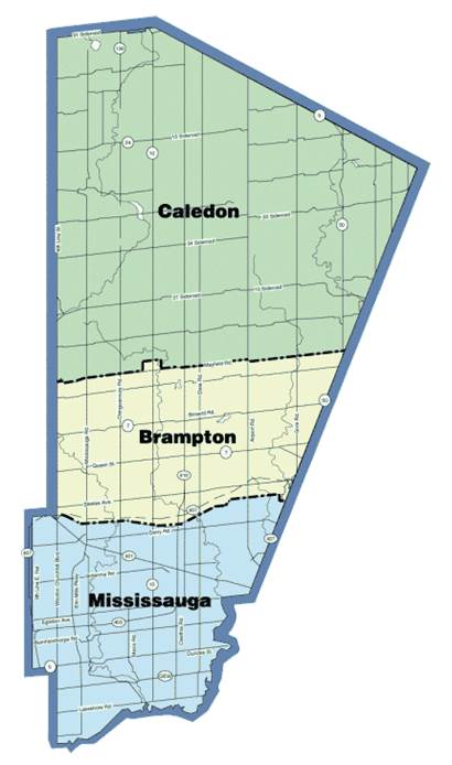
The Regional Municipality of Peel is located immediately to the west of Toronto in Ontario, Canada. It comprises three municipalities: the cities of Mississauga and Brampton, and the Town of Caledon. The current population stands at approximately 1.4 million people. What follows is a short history of the area.

The Region of Peel in the context of the Greater Toronto Area (GTA) on the north shore of Lake Ontario, Ontario, Canada.
The Peel area has a richly interwoven documentary heritage – discussed here: https://peelarchivesblog.com/2023/05/15/peels-shared-archival-legacy/
The History of Peel Region, Ontario, Canada
Indigenous heritage
During most of the 1600s the Iroquois Confederacy or Five Nations controlled vast portions of Southern Ontario, including the area that is now Peel. Around 1700 the Iroquois, weakened by disease and warfare with the French, were pushed out of the area by the Anishinabeg, a group migrating southward. The Anishinabeg who settled along the north shore of Lake Ontario were given a different name by the European settlers: The Mississaugas.
The beginning of European settlement in Ontario

From: A History of Peel County to Mark its Centenary as a Separate County, 1867-1967. Brampton: County of Peel, 1967.
After the Seven Years War between Great Britain and France concluded in 1763, the French ceded overall control of what would become Quebec and Ontario to the British, who were then maintaining forts at Kingston and Niagara. The American Revolution (1775-1783) and the subsequent migration of Loyalist settlers from the newly formed United States of America to British lands convinced the British Crown of the desirability of formally acquiring new lands for settlement. As a result, the Crown began to purchase land from the Mississaugas via treaties: between 1783 and 1788 vast tracts of land within Ontario were purchased and surveyed for settlement. In 1798 the British built an inn at the mouth of the Credit River. The building, known as “The Government House,” served as a waystation for couriers who carried dispatches between Niagara and the newly created Town of York (1793).
Treaties, surveys, and European settlement in Peel: 1805 to 1820

Plan of the 1805 Purchase.
From: A History of Peel County to Mark its Centenary as a Separate County, 1867-1967. Brampton: County of Peel, 1967.
On August 2nd, 1805 the British and Mississaugas signed a treaty covering the southern portion of the “Mississauga Tract” on the Lake Ontario waterfront, reaching from the Etobicoke Creek on the east to Burlington Bay on the west, and running north to what in Peel is known as the Second Concession North of Dundas Street (also known as Eglinton Avenue). Within a year the land was surveyed and divided into “Townships” for settlement purposes. The township in the Peel area was known as Toronto Township (now the City of Mississauga). It is interesting to note that the naming of this Township predated the incorporation of the City of Toronto in 1834 (founded as the Town of York in 1793).

1818 purchase
From: Settlement History of Peel, Region of Peel report, January 1977
When Toronto Township was purchased the Mississaugas withheld a strip of land 1 mile wide on either side of the Credit River. The rest of the land was surveyed, and settlement began in earnest. Small hamlets sprung up at crossroads throughout the Township, including Summerville and Dixie. These hamlets were usually composed of a blacksmith shop, general store, church, and perhaps an inn or hotel. By 1818 the need for more land was apparent, and negotiations were started to purchase the remaining Mississauga land north of Eglinton Avenue. That same year 648,000 additional acres were purchased, and by 1819 the land was surveyed and divided into Townships. The Peel area now included an enlarged Toronto Township, as well as four additional townships: Chinguacousy, Toronto Gore, Albion, and Caledon. In February 1820 the Mississaugas surrendered the last of their lands along the Credit River, only keeping a small piece for a village that they subsequently abandoned in 1847 (now the Mississaugua Golf and Country Club).
Townships, Districts, and early government in Peel, 1805 – 1851
When the various Peel Townships came into existence between 1805 and 1819, they were administered by the Home District Court of Quarter Sessions out of York. This body was appointed by the Lieutenant-Governor and was composed of Justices of the Peace (also known as Magistrates of the Quarter Sessions) and other officials including a Clerk, a Sheriff, and a Treasurer. Townships were allowed to elect officials for minor matters, but they had very little authority and were always under the supervision of the magistrates. In 1841 legislation was passed changing the various District Courts from appointed bodies to elected bodies (thus creating a “Home District Council”), and then in 1850 the Districts themselves were dissolved in favour of smaller administrative units – Counties.

Detail of Plan of the Indian Reserve, River Credit 1849
Peel archives at PAMA, Region of Peel map and plan collection, 2005.101.
From January 1850 to December 1851 the Peel area townships were administered by the County of York, composing the “Second Riding” of that county:

Annotated map of York and Simcoe Counties, showing the Peel area as the “Second Riding,” 1850, Wm. Perkins Bull fonds
Peel County, 1852-1973

County of Peel, showing townships
From: Settlement History of Peel, Region of Peel report, January 1977
Peel County, named after Sir Robert Peel (1788-1850), a British politician who had previously served as both the Home Secretary and Prime Minister of Great Britain, was created in 1852 as part of the United Counties of York, Peel, and Ontario. Upon formation Peel was composed of the Townships of Toronto, Chinguacousy, Toronto Gore, Albion, and Caledon. Ontario County separated in 1854, leaving York and Peel joined, administered out of the City of Toronto. In 1867, after much discussion and debate, Peel officially separated from York, having built the necessary administrative buildings: a courthouse (with council chamber) and a jail.
As of 1850 each township was able to elect a council and to manage various local affairs, including upkeep of municipal roads, assessment of properties for tax purposes, provision of public utilities (water and electricity), operation of libraries, and providing firefighting and policing services.
The County was responsible for (among other things) the operation of the jail and courthouse, the construction and maintenance of County roads and bridges, the operation of a Home for the Aged, oversight of a Health Unit, and drafting and implementing Peel’s emergency operational plan (in the advent of natural disaster or war).

James Cook property, Toronto Gore, near Malton, 1933.
Peel Archives at PAMA, William Perkins Bull fonds, Agriculture series, file 5.
The Peel area was originally settled as a rural farming community, composed of vast tracts of farmland punctuated with small crossroad hamlets. With the building of grist and woolen mills and the coming of the railroad through Peel, various settlements grew in prominence, including Port Credit, Streetsville, and Malton in Toronto Township, Brampton in Chinguacousy Township, Caledon East in Caledon Township, and Bolton in Albion Township.
As settlements grew there was a shift away from self-sufficient family farms to the creation of larger farms with a more urban focus, and the economy saw an upswing in industrial growth. Rail connections to Guelph, Barrie, and Toronto ensured that people and products could be moved at an ever increasing rate, driving both migration and innovation.

Credit Valley Railway locomotive #163 at the Forks of the Credit trestle bridge ca. 1885.
Peel Archives at PAMA, Vincent McEnaney collection.

From County to Region
The extent of urban and industrial growth after the Second World War put great pressure on many County governments within Ontario. More Regional cooperation was seen as a possible solution. Under the proposed “Regional Government” model, regional planning initiatives and costly large scale programs & services would be administered by the upper tier government, with more local services provided by the lower tier government. The model was first implemented in York County, with the creation of the Regional Municipality of Metropolitan Toronto (1953).

In 1974, after much research, discussion, and debate, a regional government structure was created for Peel by provincial legislation. The old County of Peel was dissolved, and was replaced with the Region of Peel as the upper tier municipality.This new regional government was given more responsibility than the former county and by 2015 it was responsible for (among other things) water delivery, public health, waste management, paramedic services, long-term care facilities, and policing. The former five Townships along with their respective towns and villages were amalgamated into the Cities of Mississauga and Brampton and the Town of Caledon. They, as lower tier governments, were given control over local affairs, including property assessment & tax collection, parks & recreation, public transit, firefighting, and libraries. Development and population growth continued to accelerate. In 1974 the population of the Peel area was 334, 750; by 2014 it had grown to over 1,350,000. Immigration was a driving factor in this growth, with new immigrants comprising 49% of the total.

Segment of a mock-up for the Region of Peel flag ca. 1979.
Peel Archives , Region of Peel fonds, 1991.089.
Conclusion
Peel has evolved from a farming community primarily settled by Europeans, to a thriving collection of rural and urban communities, populated with a diverse range of people from all over the world. The Peel Archives proudly collects and makes available a wide range of records that document this rich and vibrant history.
Further reading
- Settlement History of Peel (Region of Peel report, January 1977)
- Handbook of Upper Canadian Chronology by Frederick H. Armstrong (1985)
- Sacred Feathers: The Reverend Peter Jones (Kahkewaquonaby) and the Mississauga Indians (Second Edition) by Donald B. Smith (2013)
- A history of Peel County to mark its centenary as a separate county, 1867-1967 (1967)
All of these titles are available for consultation in the Reading Room.
Map of GTA via Wikimedia Commons.

Pingback: Why Council Records Matter | Archives @ PAMA·
Pingback: What do archivists do all day? | Archives @ PAMA·
Pingback: Mapping Peel: An exploration of maps from the Peel Archives, 1805-2013 | Archives @ PAMA·
Pingback: Old and New World Archives share the past, present, and future: The Cumbrian Connection, Part 1 | Archives @ PAMA·
Pingback: Why BYLAWS Matter | Archives @ PAMA·
Pingback: From mud to pavement: the early history of Peel roadways as told by our records | Archives @ PAMA·
Pingback: Notable Events in Brampton’s History | Life, eh?·
Pingback: The creation of the County of Peel, 1851-1867 | Archives @ PAMA·
Pingback: “From Hemisphere to Hamlet:” Research on the Indigenous peoples of the County of Peel and North America within the Wm. Perkins Bull fonds | Archives @ PAMA·
Do you have a book in the archives “Dreams of long ago” mainly about Lorne Park around 1919
LikeLike
Hi Dawna, Sorry about the delayed response. For reference inquiries can you email us at PAMAArchives@peelregion.ca? I believe we do have that book in our reference collection but will not be able to check until Tuesday – please remind us of your question next week via email. FYI our copy would be non-circulating; the Mississauga Library System has 4 circulating copies. Search their catalogue at https://miss.ent.sirsidynix.net/client/en_US/mlsathome/
LikeLike
Pingback: Halloween in Peel: A look at some selected records | Archives @ PAMA·
Pingback: Recent acquisition highlight: Peel railway records | Archives @ PAMA·
Pingback: The Archivist as detective: The use of “diplomatics” in a municipal archive | Archives @ PAMA·
Pingback: Researching the “woodland world”: Historic vegetation in Peel | Archives @ PAMA·
Pingback: Why I love government records | Archives @ PAMA·
Pingback: An archivist’s night at the movies, part IV: Science fiction edition | Archives @ PAMA·
How many cemeteries are in the Peel region? I have a grandfather that I have been trying to track down. He was born about 1848 in Holland Township, Ontario. There must be100s of George Whites born about that time!!!! I believe he died sometime after 1913 and Peel was mentioned. His name was George White.
LikeLike
Hi Bonnie – the Peel Data Centre maintains an inventory of all known cemeteries in the Peel area: https://data.peelregion.ca/datasets/RegionofPeel::cemetery/explore?location=43.730124%2C-79.829366%2C10.76. Listings of known headstones found in many of those cemeteries are created and maintained by the Halton-Peel Ontario Genealogical Society. If you send me an email at PAMAArchives@Peelregion.ca I can let you know about some other possible avenues – thanks!
LikeLike
Pingback: The case of the mysterious Mississauga Public Utility Commission records | Archives @ PAMA·
Pingback: Ghosts of Christmases past in Peel and beyond | Peeling the Past·